
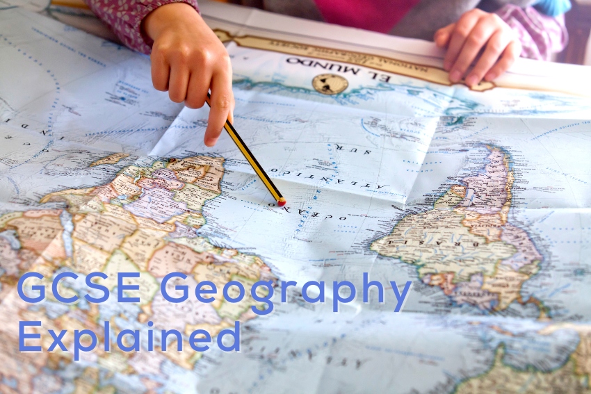
GCSE Geography – Everything You Need to Know
In the age of globalisation, understanding our planet’s intricate tapestry becomes not just a subject in school, but a pivotal life skill. GCSE Geography, with its blend of physical landscapes and human narratives, opens a window to this vast, interconnected world. Whether you’re a parent keen to support your child’s academic journey or a student aiming to grasp the subject’s depth, this guide offers invaluable insights.
A Brief Overview of GCSEs
The GCSE system stands as one of the UK’s educational cornerstones, guiding students through their formative years and setting the stage for advanced studies. Since its inception, GCSEs have continually evolved, reflecting both current academic demands and broader societal shifts. With subjects ranging from core sciences and mathematics to humanities and the arts, GCSEs offer a diverse palette of study options. Their outcomes, more than just grades on paper, often act as significant influencers in shaping a student’s future, whether it’s choosing A-level subjects, vocational training, or exploring early career paths. This article delves deeper into the nuances of GCSE Geography, unpacking its structure, challenges, and the tools available to help students thrive.
Decoding the GCSE Geography Grading Scheme
Navigating the GCSE Geography grading scheme can initially appear a touch daunting, but with clarity, it becomes a straightforward road map of a student’s academic journey. Traditionally, the GCSE grading system used alphabets, but in recent years, it shifted to a numerical scale of 9-1, with 9 signifying top-tier performance. This transformation wasn’t merely cosmetic; it aimed to offer a more differentiated performance evaluation. In GCSE Geography, these grades reflect a student’s grasp of intricate concepts ranging from physical landscapes and processes to the complexities of human environments. As we venture further into this guide, we’ll illuminate the benchmarks for each grade, demystifying what examiners seek and how students can align their preparations accordingly.
Key Topics in GCSE Geography
Dive into the world of GCSE Geography, and you’ll embark on a dynamic journey, unravelling the planet’s fascinating tapestry. The curriculum, rich and diverse, is designed to provide students with a holistic understanding of our world’s interconnected systems.
1. Physical Geography
Delve deep into the natural processes and features that shape our world. From the roiling dynamics of tectonic plates and volcanic activity to the serene beauty of coastal landscapes and river valleys, physical geography paints a vivid picture of Earth’s natural artistry.
2. Human Geography
Transition from the natural world to the realm of human societies, and you encounter a myriad of topics.
- Urbanisation
Experience the rapid pulse of cities expanding and evolving.
- Migration Patterns
Trace the shifting dynamics of people moving across regions and continents.
- Resource Management
Discover how societies manage and allocate their most vital assets.
3. Environmental Geography
Standing at the confluence of physical and human geographies, this segment explores the delicate balance between nature and human intervention.
- Sustainable Development
Explore the principles guiding progress that doesn’t deplete our resources.
- Climate Change
Understand the challenges our planet faces due to changing climate patterns.
- Conservation
Learn about the measures in place to protect our planet’s biodiversity and ecosystems.
As we navigate further, we’ll deep dive into each of these areas, uncovering the intricate details that make GCSE Geography not just an academic subject, but a lens through which we interpret our ever-evolving world.

Common Hurdles in GCSE Geography
GCSE Geography, with its expansive curriculum, presents a series of challenges that even the most diligent students might grapple with. Recognising these hurdles is the first step towards overcoming them.
Conceptual Complexity
While Geography often starts with foundational concepts, as students progress, they’re introduced to more intricate theories and ideas.
Case Study Details
Remembering the specifics of diverse case studies, from locations to statistical data, can be taxing. It’s not just about rote memorisation, but understanding the context and implications of each study.
Real-world Application
Theoretical knowledge is one thing; applying it to real-world scenarios is another. Students often struggle to correlate their textbook knowledge with contemporary geographical issues.
Skills and Techniques
Map Reading and Interpretation
A quintessential skill in Geography, yet many find it challenging to decipher intricate map symbols, contours, or predict spatial outcomes based on given data.
Data Analysis
From graphs to population pyramids, interpreting and drawing insights from varied data sets demands a meticulous approach, often becoming a stumbling block for many.
Time Management
The vast scope of the subject often leads students to spend disproportionate amounts of time on specific topics, leaving others underprepared.
Exam Strategy
Crafting precise and relevant answers within limited time frames can be daunting, especially when faced with unexpected questions.
Varied Assessment Formats
Geography assessments aren’t just about writing; they encompass fieldwork, data interpretation, and sometimes even oral presentations, requiring a diverse skill set.
By shedding light on these common challenges, we aim to provide strategies and insights to navigate GCSE Geography more confidently, turning potential pitfalls into stepping stones for success.
Sample GCSE Geography Exam Questions
1. River Landscapes
Question: Explain how meanders and oxbow lakes are formed in a river’s middle course.
Answer:
Meanders form due to the lateral (sideways) erosion of river banks. On the outer bend of a meander, water flows faster, causing erosion and making the bend broader over time. Conversely, on the inner bend where water flows slower, deposition occurs. An oxbow lake forms when a meander becomes so pronounced that the river cuts through the narrow piece of land during a flood, separating the meander from the main river. Over time, deposition seals off the old meander, forming an oxbow lake.
Explanation:
In the middle course of a river, the river has more energy and volume, leading to lateral erosion. This dynamic between erosion on the outer bends and deposition on the inner bends gives the river its characteristic winding pattern. When the river takes a shortcut and bypasses a particularly large meander, the meander can become isolated from the river’s flow, eventually forming an oxbow lake.
Common Mistakes Include:
- Not differentiating between the processes of erosion on the outer bend and deposition on the inner bend.
- Misunderstanding the sequence of events leading to the formation of an oxbow lake.
- Failing to associate the formation of these features with the river’s middle course.
2. Urbanisation
Question: Discuss the primary reasons for rapid urbanisation in developing countries over the past three decades.
Answer:
The primary reasons include rural-urban migration driven by perceived better employment opportunities in cities, industrialisation leading to job creation in urban areas, higher birth rates in cities, and governmental policies favouring urban development.
Explanation:
In developing countries, many people move from rural areas to cities hoping for a better quality of life. Often, cities are seen as places with better healthcare, education, and job opportunities. Additionally, as countries develop, they often go through a phase of industrialisation, where industries are typically set up in or around cities. This attracts a workforce. Lastly, urban areas tend to have a higher population growth due to both migration and higher birth rates.
Common Mistakes:
- Overemphasis on one factor without recognising the multifaceted reasons behind urbanisation.
- Not tying back the reasons to the specific context of developing countries.
- Ignoring the role of government policies in urban development.
3. Climate Change
Question: How do human activities, especially in terms of carbon emissions, influence the greenhouse effect and contribute to global warming?
Answer:
Human activities, particularly the burning of fossil fuels like coal, oil, and natural gas, release large amounts of carbon dioxide (CO2) into the atmosphere. This CO2, being a greenhouse gas, traps heat from the sun’s rays within the Earth’s atmosphere. The more CO2 and other greenhouse gases we release, the more heat gets trapped, intensifying the natural greenhouse effect, leading to global warming.
Explanation:
The Earth’s atmosphere naturally contains greenhouse gases like CO2 and methane. These gases trap some of the sun’s heat, making our planet hospitable. However, human activities have drastically increased the concentration of these gases, especially CO2, amplifying the heat-trapping effect, causing global temperatures to rise.
Common Mistakes:
- Confusing the natural greenhouse effect with the enhanced greenhouse effect caused by human activities.
- Overlooking other greenhouse gases like methane and nitrous oxide.
- Not linking the increase in greenhouse gases directly to human activities.
4. Population Dynamics
Question: Describe the demographic transition model, highlighting the key characteristics of each stage.
Answer:
The demographic transition model illustrates the shift a country undergoes from high birth and death rates to low birth and death rates through stages of economic development. It has five stages:
- Stage 1 (High Stationary): High birth and death rates due to limited medical knowledge, no family planning, and reliance on subsistence farming.
- Stage 2 (Early Expanding): Death rates fall due to improved healthcare and sanitation. Birth rates remain high, leading to a population surge.
- Stage 3 (Late Expanding): Birth rates start to decline due to improved economic conditions, better education, and family planning. Population growth slows down.
- Stage 4 (Low Stationary): Both birth and death rates are low, stabilising population growth. This is due to urbanisation, increased women’s rights, and access to contraception.
- Stage 5 (Decline): The birth rate falls below the death rate, leading to a declining population. This can be due to high living costs, lifestyle choices, and urbanisation.
Explanation:
The model represents how socio-economic changes, particularly in healthcare, living conditions, and societal values, influence birth and death rates, ultimately affecting population growth over time.
Common Mistakes:
- Mixing up the sequence of stages.
- Not explaining the socio-economic reasons behind shifts in birth and death rates.
- Overlooking the potential for a fifth stage where the population starts declining.
5. Tectonic Processes
Question: Using examples, explain the difference between constructive and destructive plate boundaries.
Answer:
Constructive plate boundaries (or divergent boundaries) occur when two tectonic plates move away from each other. As they separate, magma rises from the mantle, solidifies, and forms new crust. An example is the Mid-Atlantic Ridge. Destructive plate boundaries (or convergent boundaries) are where two plates move towards each other. When an oceanic plate collides with a continental plate, the denser oceanic plate is forced under the continental plate in a process called subduction. This often leads to volcanic activity and mountain formation. An example is the boundary between the Pacific Plate and the North American Plate.
Explanation:
Constructive boundaries are characterised by the creation of new crust as magma rises, while destructive boundaries are marked by the destruction or deformation of crust due to plate collisions and subduction.
Common Mistakes:
- Confusing the direction of plate movement in each boundary type.
- Not providing specific examples to illustrate each boundary type.
- Overlooking the associated geological features, like volcanoes or mid-ocean ridges.
By examining these questions and their explanations, students can gain a clearer understanding of what’s expected in their responses and sidestep common pitfalls.
Certainly, let’s delve into some more advanced GCSE Geography questions:
Sample Advanced GCSE Geography Exam Questions
1. Geopolitics and Conflict
Question: How can competing territorial claims over resources lead to geopolitical conflicts? Use specific examples in your answer.
Answer:
Competing territorial claims often arise when two or more countries assert sovereignty over a region rich in resources. These resources, be they minerals, oil, or fertile land, can be economically and strategically vital. For instance, the South China Sea dispute involves multiple countries vying for control over waters believed to be rich in oil and natural gas reserves. Similarly, the conflict between India and Pakistan over Kashmir can, in part, be attributed to the region’s water resources and strategic military importance.
Explanation:
Territorial disputes are not just about land, but the resources and strategic advantages that come with it. These disputes can escalate to geopolitical conflicts, especially when they concern vital resources or have historical or cultural significance.
Common Mistakes:
- Providing a general answer without specific examples.
- Overlooking the cultural or historical factors that often intertwine with resource disputes.
- Not identifying the strategic importance of certain resources.
2. Globalisation and Economic Geography
Question: Discuss the impact of globalisation on local economies, considering both the benefits and drawbacks.
Answer:
Globalisation, the process by which businesses and other organisations develop international influence, has profound effects on local economies. On one hand, it can bring investment, technology, and job opportunities to areas previously isolated from global trade. For instance, many cities in Asia, like Bangalore in India, have flourished as hubs for IT due to globalisation. Conversely, local industries can suffer when they’re unable to compete with larger multinational corporations, leading to unemployment and economic downturns. Many traditional crafts and industries in regions of Africa have struggled in the face of cheap, mass-produced imports.
Explanation:
While globalisation can act as a catalyst for economic growth, bringing with it technology and innovation, it can also lead to the decline of traditional industries and increase dependency on foreign investments and markets.
Common Mistakes:
- Viewing globalisation solely as a positive or negative force, rather than a complex phenomenon with varied impacts.
- Not providing specific regional or sectoral examples.
- Overlooking the cultural implications of globalisation on local economies.
3. Sustainability and Urban Planning
Question: How can principles of sustainability be integrated into urban planning? Provide examples of cities that have successfully done so.
Answer:
Sustainability in urban planning refers to creating cities that do not deplete resources and can function in the long term. This includes ensuring efficient public transport to reduce emissions, as seen in cities like Copenhagen. Green spaces and urban agriculture can enhance biodiversity and local food production, as practised in Singapore’s “City in a Garden” vision. Efficient waste management, recycling, and sustainable housing are also integral. Curitiba in Brazil, for example, is hailed for its innovative transportation and waste management systems.
Explanation:
Incorporating sustainability into urban planning ensures that cities can meet the needs of their current inhabitants without compromising the ability of future generations to meet their own needs. This involves a balance between economic, social, and environmental factors.
Common Mistakes:
- Giving generic sustainability solutions without tying them to urban contexts.
- Focusing solely on environmental sustainability, neglecting social and economic dimensions.
- Not providing real-world city examples.
4. Biodiversity and Conservation
Question: Analyse the role of global treaties and international cooperation in conserving biodiversity.
Answer:
Global treaties play a pivotal role in uniting countries towards a common goal of conserving biodiversity. The Convention on Biological Diversity (CBD), for example, aims to conserve biological diversity, ensure sustainable use of components, and enable fair sharing of benefits. Another is the CITES treaty which regulates international trade in wild fauna and flora. International cooperation allows for pooling of resources, exchange of expertise, and monitoring of biodiversity hotspots that span multiple countries, ensuring species and ecosystems are protected across borders.
Explanation:
While individual countries can take measures to protect their biodiversity, many challenges are global in nature and require international collaboration. Treaties provide the framework and guidelines for such cooperation, ensuring unified action.
Common Mistakes:
- Not differentiating between different global treaties or misunderstanding their objectives.
- Overlooking the challenges and criticisms related to the implementation of these treaties.
- Neglecting the importance of local and indigenous knowledge in global conservation efforts.
5. Climate Science and Predictions
Question: How do scientists use climate models to make predictions about future climate change, and what are the uncertainties involved?
Answer:
Climate models are computational tools that simulate the interactions of atmospheric, oceanic, and terrestrial processes. They use historical data and current observations to project future climate patterns. These models can range from simple energy balance models to complex General Circulation Models (GCMs). However, there are uncertainties due to unpredictable human behaviours (like future CO2 emissions), feedback mechanisms in the climate system, and the natural variability of climate. For instance, while models might predict temperature rises, the exact magnitude and localised effects can vary.
Explanation:
While climate models provide invaluable insights into future climate patterns and help guide policy, they are based on assumptions and contain inherent uncertainties. Recognising these uncertainties is vital when making long-term decisions based on model outputs.
Common Mistakes:
- Assuming that climate models provide exact predictions rather than probable scenarios.
- Overlooking the inherent variability in the Earth’s climate system.
- Not understanding the difference between short-term weather predictions and long-term climate modelling.
By delving into these advanced topics, students can gain deeper insights into the complexities of geographical phenomena, their interconnectedness, and the real-world implications of their studies.
GCSE Geography Marking Scheme Explained
Navigating the intricacies of any exam system can be challenging for both students and parents alike. When it comes to the GCSE Geography exam, understanding the marking scheme can be pivotal to guiding revision efforts and ensuring successful results. In this section, we’ll demystify the GCSE Geography marking scheme to help you comprehend how examiners allocate those crucial marks.
Components and Weighting
Every exam board has slightly different components and weightings, but there is a general structure that many follow:
Paper 1: Physical Geography
- Covers topics like natural hazards, river landscapes, and coastal landscapes.
- Typically worth around 35% of the total marks.
Paper 2: Human Geography
- Delves into urban issues, economic development, and resource management.
- Often accounts for another 35% of the total grade.
Paper 3: Geographical Applications
- This is a more skills-based paper, where students might interpret data, analyse fieldwork or respond to pre-released material.
- Usually constitutes the remaining 30% of the marks.
Mark Allocation by Question Type
Understanding the types of questions posed and how they are marked can make a big difference:
Multiple Choice Questions
- Straightforward in marking—either the answer is correct or it isn’t.
Short Answer Questions
- These usually carry 1 to 4 marks.
- Marks are awarded for each correct point or detail provided.
Extended Responses
- These can range from 6 to 9 marks.
- Marks are typically divided between making clear points, providing evidence or examples, and offering a balanced or evaluated view.
Data Response Questions
- Students might be asked to interpret graphs, maps, or other data sources.
- Marks are given for accurate interpretation, understanding of geographical concepts, and sometimes for linking data to wider geographical knowledge.
Command Words
Examiners use specific command words in questions, and understanding these is key to achieving full marks:
Describe
- Here, students should give an account of what they see or know, without needing to explain why.
Explain
- This requires students to provide reasons or causes for a particular phenomenon.
Evaluate
- This is more analytical and may require students to weigh up different sides of an issue or argument.
Compare
- Students should identify similarities and differences between two or more factors.
Additional Considerations
Spelling and Grammar
- While the primary focus is on geographical knowledge, some marks (especially in extended responses) are allocated for clarity, coherence, and proper use of English.
Use of Case Studies
- Specific examples or case studies can strengthen answers. Some questions may explicitly require them, and they can provide crucial marks.
Understanding the marking scheme is like having a roadmap for the exam. It shows where the pitfalls are, where marks can be easily gained, and how to navigate complex questions. For students aiming for top marks, it’s invaluable to grasp not just the content of the syllabus, but also the mechanics of how it’s assessed.
Effective GCSE Geography Revision Resources for Success
For GCSE Geography students, the path to acing the exam doesn’t just lie in understanding complex geographical concepts, but also in employing the right revision resources and techniques. Here’s a guide to some of the most effective geography-specific tools and resources that can bolster a student’s preparation.
Digital Geographic Information Systems (GIS)
- What it is: GIS platforms allow students to visualise, question, and interpret data to understand spatial patterns and trends.
- Why it’s useful: Hands-on experience with GIS can help students link theory with practice and gain a deeper understanding of topics such as urban planning, biodiversity conservation, or climate modelling.
Online Interactive Maps
- What it is: Websites and apps that offer dynamic maps which can be customised to display specific geographical data.
- Why it’s useful: These maps can help students visualise population distributions, climatic zones, river systems, and other geographic phenomena. Interactive elements can make revision more engaging.
Past Papers and Mark Schemes
- What it is: Previous years’ GCSE Geography exam papers along with their corresponding mark schemes.
- Why it’s useful: Regularly practicing past papers can familiarise students with the exam format, timing, and types of questions asked. Mark schemes provide insights into what examiners are looking for in answers.
Geography Podcasts and Videos
- What it is: Audio or video content focusing on geographic topics, research, or case studies.
- Why it’s useful: Visual and auditory learning can reinforce written materials, especially for complex topics or real-world examples.
Case Study Cards
- What it is: Concise, detailed cards focusing on specific geographic case studies.
- Why it’s useful: Case studies are crucial for many GCSE Geography answers. Having a set of flashcards can help students quickly revise and remember key facts, figures, and outcomes.
Online Geography Quizzes and Games
- What it is: Digital platforms or apps that provide quizzes, puzzles, or games focused on geographic facts and concepts. Check out Quizlet and Kahoot.
- Why it’s useful: A fun way to test and reinforce knowledge. It can be particularly useful for remembering factual data, such as capital cities, river lengths, or mountain ranges.
Fieldwork Notes and Photographs
- What it is: Notes and images captured during any geography field trips or practical sessions.
- Why it’s useful: Fieldwork is an integral part of the GCSE Geography curriculum. Revisiting notes and photographs can help solidify memories and deepen understanding of practical applications.
The right resources can make all the difference, turning a challenging revision period into a productive, enlightening experience. By incorporating these geography-specific tools into their study routine, students can approach their GCSE Geography exam with confidence and clarity.
The Benefits of GCSE Geography Tuition
As parents, we’re always looking for ways to support our children’s educational journeys. With the ever-evolving world of geography, GCSE Geography tuition offers a distinct advantage to students, allowing them to explore the world without leaving their desks. Let’s delve into the specific benefits of geography tuition, especially in an online setting.
Personalised Learning Experiences
- Geographical Focus: Every student has unique strengths and challenges. Some might excel in physical geography but struggle with human geography topics. A dedicated tutor can tailor lessons to a student’s needs, ensuring they grasp even the most challenging concepts.
Enhanced Use of Digital Tools and Resources
- Geographical Focus: In today’s digital age, geography is no longer just about reading maps. It’s about analysing satellite imagery, working with GIS software, and interpreting complex data sets. Tutors can introduce students to these digital tools, enhancing their real-world applicability and understanding.
Dive Deep into Case Studies
- Geographical Focus: Case studies are foundational in GCSE Geography. With a tutor’s guidance, students can delve deeper into specific examples, extracting nuances and complexities that can set their answers apart in exams.
Fieldwork Support
- Geographical Focus: Fieldwork, though exciting, can be overwhelming. A tutor can help students make sense of their observations, ensuring they can articulate their findings clearly in exams.
Flexibility and Convenience with Online Learning
- Geographical Focus: Whether exploring urban landscapes or remote rainforests, online tuition breaks geographical barriers, enabling students to explore global case studies with expert tutors from around the world.
- Online Tuition Advantages: The convenience of online learning means no commuting to tuition centres, allowing for more flexible scheduling. Plus, online platforms often have integrated tools and resources, enriching the learning experience.
Consistent Feedback and Progress Tracking
- Geographical Focus: Geography’s vast syllabus can be daunting. Regular sessions with a tutor provide consistent feedback, helping students understand where they stand and what areas need more focus.
By complementing school lessons with GCSE Geography tuition, especially in an online setting, students gain an edge. They receive targeted support, access to vast resources, and the confidence that they are fully prepared to navigate the intricate world of GCSE Geography. As the world becomes increasingly interconnected, having a comprehensive grasp of geography is more crucial than ever, and tailored tuition is a step in the right direction.
A Global Perspective for Tomorrow’s Leaders
In an era where the boundaries between nations are becoming increasingly fluid, the importance of understanding our planet cannot be overstated. GCSE Geography offers students more than just knowledge—it provides a lens through which to view the world, fostering critical thinking, empathy, and a profound appreciation for the intricacies of our shared environment.
But as with any journey, it’s not just about the destination, but also the companions you choose. Edumentors is more than just an online tutoring platform; it’s a gateway to a community of academic trailblasers. With Edumentors’ GCSE geography tutors hailing from the UK’s premier universities, they bring fresh, innovative insights from the very forefront of academic achievement.
Embracing this level of expertise not only ensures a deeper understanding of geographical concepts but also empowers students to approach their exams with unwavering confidence. More than just a boost in grades, it’s about shaping individuals who are ready to make a difference in the world.
As we stand on the precipice of tomorrow, let us ensure our students are equipped with not just knowledge, but also the passion and perspective to lead. With Edumentors by their side, the journey becomes not just easier, but truly transformative.

What is a Conditional Offer?


